Sports‪» Outdoor activities‪» Electronics‪» GPS‪» Hiking GPS‪»

Garmin GPSMAP 66i and TopoActive Europe

Garmin GPSMAP 66i and TopoActive Europe

Garmin GPSMAP 66i and TopoActive Europe

Campaign price
573,14 + delivery costs
Lowest price within 30 days 584,10 €
Offer ends in
Normal price 649,00 €
Incl. VAT 24 %


Quantity
pc


Available in stock
Store (Helsinki)on-shelf2 pcs immediately
Available in the webstore2 pcs immediately

Product code
010-02088-02
Bar code
753759218744

See also
Map
National Land Survey Of Finland: Electronic Map of Finland in microSD
+25,00 €

Availability
Immediately

Detailed availability

Location Store (Helsinki): Trekking, 12


Reviews
Overall rating ()


Product description
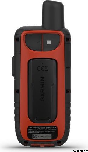
Rugged GPS handheld and inReach satellite communicator with Garmin TopoActive Europe mapping.
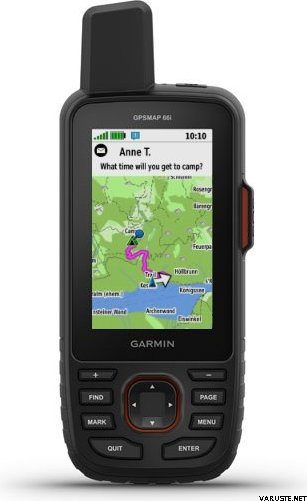
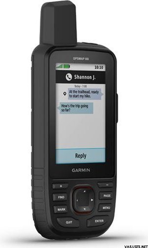
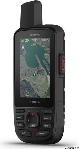
  • Large 3" sunlight-readable colour display for easy viewing
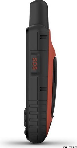
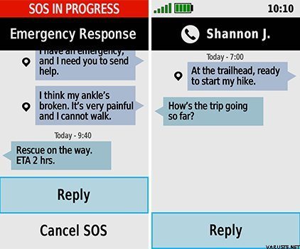
  • Trigger an interactive SOS to the GEOS 24/7 search and rescue monitoring center; two-way messaging via the 100% global Iridium® satellite network (satellite subscription required)
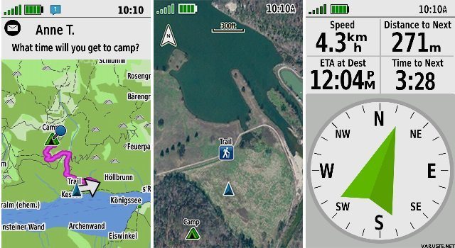
  • Preloaded Garmin TopoActive Europe mapping with direct-to-device BirdsEye Satellite Imagery downloads (no annual subscription); includes multiple Global Navigation Satellite Systems (GNSS) support and navigation sensors
  • Cellular connectivity lets you access Active Weather forecasts and Geocaching Live
  • Compatible with the Garmin Explore™ website and app to help you manage waypoints, routes, activities and collections, use tracks and review trip data from the field
  • Internal, rechargeable lithium battery provides up to 35 hours of battery life in 10-minute tracking mode; 200 hours in Expedition mode with 30-minute tracking intervals
The sturdy, button-operated GPSMAP 66i features a large 3" colour display you can see even in bright sunlight. If you're out in the field for long stretches of time, you can turn on Expedition mode and get up to 200 hours of battery life while using inReach technology. In the default tracking mode, you get up to 35 hours of battery life, and your device will save your location every 10 minutes.

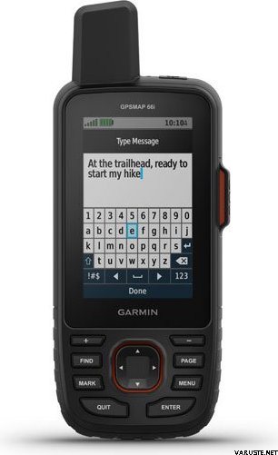
Staying in touch is vital, even on less challenging trips. Using inReach technology (subscription required), this handheld lets you trigger an SOS to the GEOS 24/7 emergency response team for interactive support in an emergency. It also enables two-way messaging and LiveTrack location sharing via the 100% global Iridium satellite network, so you can stay in contact with loved ones, teammates, headquarters and more.

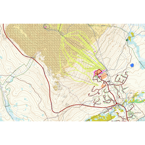
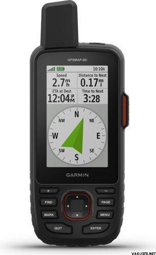
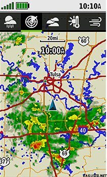
GPSMAP 66i is fitted with the best in Garmin navigation. Preloaded Garmin TopoActive Europe mapping provides detailed views of topographic elevations, summits, parks, coastlines, rivers, lakes and geographical points. Direct-to-device downloads of BirdsEye Satellite Imagery provide high-resolution photo-realistic views of your route, trailheads, clearings and more — without an annual subscription. Support for multi-GNSS combined with altimeter, barometer and compass navigation sensors lets you track and navigate in challenging environments.

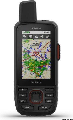
Wireless cellular connectivity lets you access Active Weather for up-to-date forecasts, including predictive maps for temperature, wind, precipitation and clouds — right on the handheld when connected to Garmin Connect Mobile.

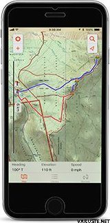
The free Garmin Explore mobile app lets you plan, review and sync data, including waypoints, routes, activities and collections. Review completed activities while still in the field, even when you're off the grid. The app also lets you sync your GPSMAP 66i with your compatible mobile device so you can access unlimited maps, aerial imagery and U.S. NOAA charts. You can even use all of the inReach features on your paired mobile device. For easier messaging, you can access your phone's contact list from the Garmin Explore app to connect with fewer keystrokes. Plan for future trips and review previous activities from the Garmin Explore website.

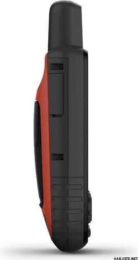
Physical dimensions 6.6 x 16.3 x 3.5 cm
Display size 3.8 x 6.3 cm; 3" diag (7.6 cm)
Display resolution 240 x 400 pixels
Display type Transflective colour TFT
Weight 241 g
Battery Rechargeable lithium-ion
Battery life Up to 35 hours at 10-minute tracking; up to 200 hours at 30-minute tracking (power save mode)
Water rating IPX7
Memory/history 16GB
High-sensitivity receiver
Interface High-speed USB and NMEA 0183 compatible

Maps & memory

Preloaded maps Yes (topographic)
Ability to add maps
Basemap
Storage and power capacity microSD™ card (not included)
Waypoints/favourites/locations 10,000
Routes 250
Track log 20,000 points, 250 saved gpx tracks, 300 saved fit archives

Sensors

Barometric altimeter
Compass Yes (tilt-compensated 3-axis)

In the box:
  • GPSMAP 66i
  • Access to Birdseye Satellite Imagery
  • Charging/data cable
  • Carabiner clip
  • Documentation

The approximate size of the packed product or the sales package is 60 x 180 x 160 mm.


Barometric altimeter
Yes


Battery life max (h)
200


IP Classification
IPX7


Satellite communication
Yes


Screen resolution
240 x 400


Screen size (inches)
3,0


Suitable for geocaching
Yes


Weight
0,48 kg


Warranty
24 month(s)


Country of origin
Taiwan


Comments
juk...@...om verified buyer, 19.12.2022
Overall rating
Translated by GoogleShow original
Five stars for the navigator. One of the terrain maps of Finland is left out of the package, which has no value for me because the routing does not work.

Anonymous verified buyer, 9.8.2022
Overall rating
Translated by GoogleShow original
The use requires a little practice, because there are a lot of features. In power saving mode, the battery lasts really well. Guaranteed Garmin quality.
sam...@...om verified buyer, 23.7.2021
Overall rating
Translated by GoogleShow original
Robust, reliable and "keyboard" available with gloves in hand. Just what I found myself. For the first time already dripped and grunted without any damage.
pekka U. verified buyer, 12.4.2021
Overall rating
Translated by GoogleShow original
Usage is still in its infancy and after GPSMAP64s there are a lot of differences in functionality that need to be explored and new operating models found. Picking up a weather report in the middle of the wilderness was a really good feature.
Anonymous verified buyer, 29.3.2021
Overall rating
Translated by GoogleShow original
Assured Garmin quality. Good clear maps, good screen and pretty easy to use. The satellite connection works everywhere and the location can be easily shared. Battery life too short. The device should be charged every day and the charging hole is in the back cover, so charging in your pocket is not easy either. For long hikes, the Explorer model would be the right choice.
jan w. verified buyer, 10.3.2021
Overall rating
Translated by GoogleShow original
Good device, basic features works. With self-made routes, you must be careful not to force the compass to appear at a waypoint that has already been passed from a distance, but to the next. No more connecting to the phone. No in-reach messages can be removed from the device, and contacts cannot be updated.
Teemu K. verified buyer, 11.7.2020
Overall rating
Translated by GoogleShow original
This is the model that can already be used in Finland and Europe. Nice in places where the cell phone does not work and ensures that the home receives information about the accommodation and well-being. A lot of features and battery discharge can be observed that it is enough for a tight place.
Pasi P. verified buyer, 11.6.2020
Overall rating
Translated by GoogleShow original
This is absolutely the ultimate device when hiking in wilderness areas alone. Does what he promises. It was nice to put a message at home and also get messages from outside the cellular networks. At the end of the week’s trip, there was still 30-40% left in the battery, even though monitoring was on throughout the trip.
Lasse L. verified buyer, 7.1.2020
Overall rating
Translated by GoogleShow original
Only used for a few weeks. A rugged device that has met expectations. Utilizing the telephone and the computer in various functions is still in the learning and testing phase. These higher quality operating instructions would be helpful.
Jani H. verified buyer, 4.1.2020
Overall rating
Translated by GoogleShow original
Very good game. Excellent features.
Show all (12) Add a comment

Brand


GPSMAP 66i: Premium GPS Handheld and Satellite Communicator

Products that have often been purchased with this product:


Blog

Hanki esiladattu kartta-aineisto mukaan muistikorttipaikkaisiin Garmin-laitteisiin

Myymme muistikorttipaikkaisiin Garmin GPS-laitteisiin microSD-korttia, johon on esiladattu Maanmittauslaitoksen kartta-aineiston pohjalta laadittu maastokartta (Tekijä on Teemu Peltonen. Lisensoitu Creative Commons Nimeä-Ei muutoksia-Epäkaupallinen 4.0 Muokkaamaton -lisenssillä.)...


Garmin inReach -laitteiden hyödyt ja käyttötarkoitukset

Garmin inReach -laitteet tuovat turvaa ja yhdistää sinut läheisiisi seikkailulla kuin seikkailulla Parhaat seikkailut koetaan yleensä kaukana sivistyksestä. Vuoren rinteillä kiipeiltäessä, syvällä metsässä vaellettaessa tai merellä melottaessa voi kokea olevansa rauhassa lu...