ElérhetőségEzt a terméket nem árusítjuk jelen pillanatban.
Tárolókapacitás
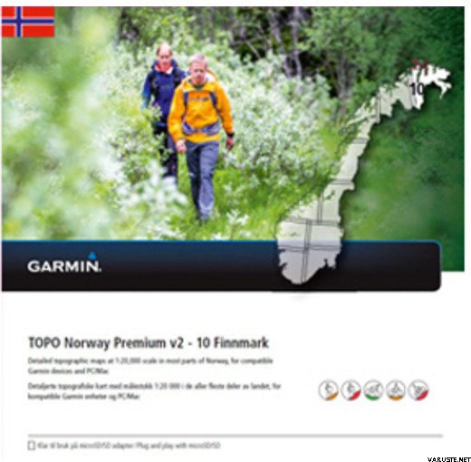
TermékleírásExplore the wild outdoors of Norway with this 1:20,000 scale topographic map that delivers supreme map detail and customized routes based on each activity profile. Available for the whole of Norway, this product is now divided into 10 regions — each region is up to two times larger than any previous similar product. Region 10 covers from North to South from Trollsundet/Vikran on the coast to Riksgrensen/Rávdovárri; and West to East from Riksgrensen/Rávdovárri to Riksgrensen (RUS) on the coast.
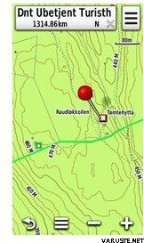
- Features the latest 1:20,000 scale topographic maps by Statens Kartverket for most parts of Norway
- Displays more than 18,000 km of hiking trails and 700 huts (nationwide), cabins and shelter locations provided by the Norwegian Trekking Association as well as bike routes for the greater Oslo area from various tourist associations in most popular outdoor regions
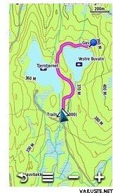
- Recommends turn-by-turn customized routes on the road and trail network, based on activity profiles for pedestrian and cycling tours
- Offers endless destinations with a database of more than 2.5 million searchable point of interests (nationwide), including fishing spots, skiing centers and resorts, campgrounds, accommodations and more
- Includes land coverage and Cadastre property information, which can help identify hunting areas
- Shows height contours (10 m intervals) for most of Norway — 20 m intervals elsewhere — and a digital elevation model (DEM) for route profile preview using our free downloadable trip-planning software, BaseCamp™, with compatible Garmin GPS devices
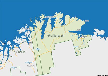
Region 10 features coverage of Norway, from North to South, from Trollsundet/Vikran on the coast to Riksgrensen/Rávdovárri; and West to East from Riksgrensen/Rávdovárri to Riksgrensen (RUS) on the coast.
Download Requirements
File Information
The file size of this download and space required on device or microSD™/SD™ card is 250 MB. If this download does not fit on your device, data may be saved on a microSD/SD card (Recycled microSD cards may be used to program map data).
24 hónap
HozzászólásokKérjük, írd meg saját észrevételedet!
Termékmárka