Garmin
190 件商品


| 一般评价 | (6 评价) |
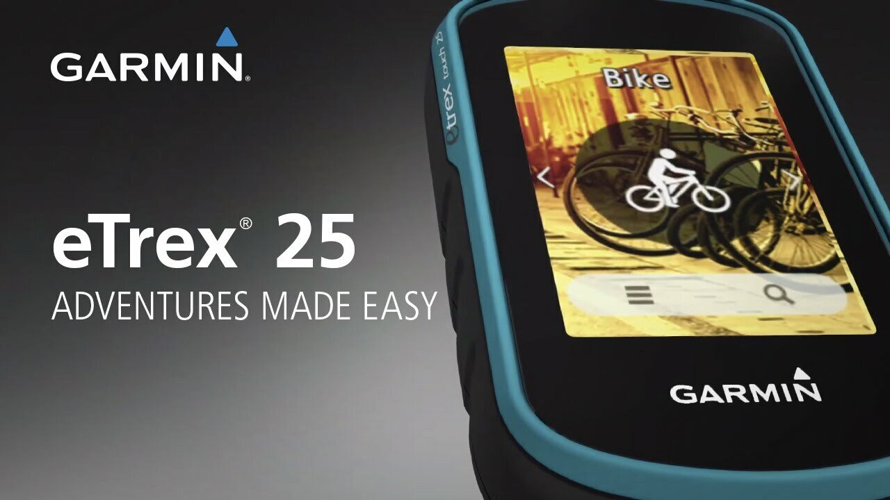
Color Touchscreen GPS/GLONASS Handheld with 3-axis Compass
Compact rugged and reliable GPS/GLONASS handheld with color touchscreen, featuring a 3-axis tilt compensated electronic compass, wireless connectivity, preloaded geocaches and expanded internal memory to hold more maps.
See the Way
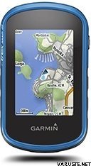
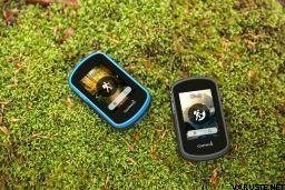
eTrex Touch 25 features a sunlight readable, 2.6-inch color touchscreen display offering intuitive access to worldwide basemap with shaded relief. Durable and waterproof, eTrex Touch 25 is built to keep delivering vital mapping and tracking data no matter what the elements throw at you, standing strong against dust, dirt, humidity and water.
New Tools for Your Trek
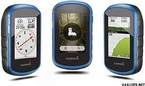
eTrex Touch 25 features a built-in 3-axis tilt-compensated electronic compass that shows your heading even when you’re standing still, and you don’t have to hold it level to get an easy-to-understand display of your heading.
Go Anywhere
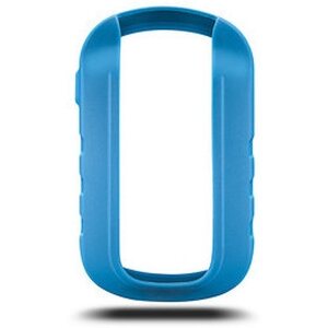
With an array of compatible mounts, eTrex Touch 25 is designed for use on ATVs, bicycles, boats, as a handheld or in your car. Wherever you think you might take eTrex, it has the mapping and mounts to get you there.
Go Global
eTrex Touch 25 can track both GPS and GLONASS satellites simultaneously. Developed by the Russian Federation, GLONASS satellites “lock on” to a position (on average) faster than GPS receivers. Using both GPS and GLONASS means the receiver has the ability to lock on to 24 more satellites than using GPS alone.
Add Maps
With its microSD™ card slot and a full 4 GB of internal memory, eTrex Touch 25 lets you load TOPO maps and hit the trail, plug in BlueChart® g2 preloaded cards for a great day on the water or City Navigator® NT map data for turn-by-turn routing on roads. eTrex Touch 25 also supports BirdsEye Satellite Imagery (subscription required) that lets you download satellite images to your device and integrate them with your maps.
Find Fun
eTrex Touch 25 is preloaded with 250,000 geocaches from Geocaching.com. By going paperless, you're not only helping the environment but also improving efficiency. eTrex Touch 25 stores and displays key information, including location, terrain, difficulty, hints and descriptions, which means no more manually entering coordinates and paper printouts. Simply upload the GPX file to your unit and start hunting for geocaches.
Plan Your Next Trip
Take charge of your next adventure with BaseCamp™, software that lets you view and organize maps, waypoints, routes and tracks. This free trip-planning software even allows you to create Garmin Adventures that you can share with friends, family or fellow explorers. BaseCamp displays topographic map data in 2-D or 3-D on your computer screen, including contour lines and elevation profiles. It also can transfer an unlimited amount of satellite images to your device when paired with a BirdsEye Satellite Imagery subscription.
Physical & Performance
Physical dimensions2.3” x 4.0” x 1.3” (5.8 x 10.2 x 3.3 cm)
Display size, WxH1.43" x 2.15" (3.6 x 5.5 cm)
Display resolution, WxH160 x 240 pixels
Display type2.6" 65K color TFT
Touchscreen
Weight5.6 oz (159 g) with batteries
Battery2 AA batteries (not included); NiMH or Lithium recommended
Battery lifeUp to 16 hours
Water ratingIPX7
High-sensitivity receiver
InterfaceUSB
Electronic compass
Maps & Memory
Basemap
Ability to add maps
Built-in memory4GB
Accepts data cardsmicroSD™ card (not included)
Custom POIs (ability to add additional points of interest)
Waypoints/favorites/locations4000
Routes200
Track log10,000 points, 200 saved tracks
Outdoor Features
Automatic routing (turn by turn routing on roads)Yes (with optional mapping for detailed roads)
Geocaching-friendlyYes (Paperless)
Custom maps compatible
Sun and moon information
Tide tablesYes (with optional Bluechart)
Area calculation
Picture viewer
Garmin Connect™
Garmin Connect™ compatible (online community where you analyze, categorize and share data)
 Taiwan
| 一般评价 | ☆☆☆☆☆ |
 — 显示原文
| 一般评价 |
— 显示原文Passeli 设备,如果您不需要太多的自行车导航功能。可更换电池是一大优势| 一般评价 |
— 显示原文小巧、轻便、耐用。当你走自己的路时,这是必须的。作为配件,背包系绳很好。| 一般评价 |
— 显示原文以 Garmin 的风格,一个非常难用的设备。触摸屏在冰冻温度下不工作。 — 显示原文该设备不如我以前的设备 Garmin Dakota 20 好用。这些设备的价格相同。
Dakota 20 设备的纤薄版本。显示更差,准确性可能更好(clonass),使用更困难且更慢。| 一般评价 |
— 显示原文一个好的设备可以满足我的需求。 — 显示原文是的,这也使用地理藏宝。也许开始缓慢,如果这困扰任何人。用户界面至少以某种方式混淆了最小的用户体验。